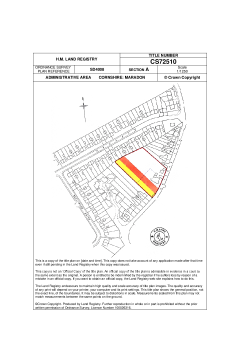
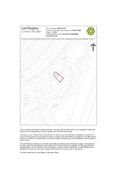
Land Registry Plan
Supplied by: Land Registry
Overview
This plan shows the owned property, registered at Land Registry under a unique title number specific to the property. Title plan maps are prepared by whichever Ordnance Survey map is available at the point of registration.
Included in the title plan:
- the title number of the land
- the land included in the title which is normally edged in red. There may be other colours or markings on the plan. The significance of these is explained in the register
- the scale at which the plan is drawn
Boundary features ownership information will be shown only if it was made available in the deeds lodged for registration.
The title plan copy will show a date and time, and does not take into account any application made after that time, including those pending in the Land Registry at the time the copy is issued.
Estimated turnaround time: Approximately 1 day
Please log in or register if you are interested in ordering this product.
Please log in or register if you are interested in ordering this product.
Popular Products

CON29DW - Residential
The official CON29DW provides comprehensive data on water supply, sewer connection status and charging arrangements
ChancelCheck Premium
A unique, online, low cost screening report, designed to analyse a large area of land to identify if there is potential to charge for repairs to the parish church chancel.